Number of results 23
for hiking
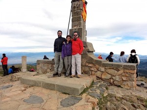
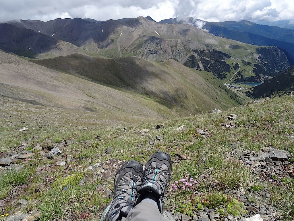
11/07/2017 - Aigüestortes - Portarró d'Espot
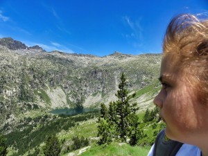 Aquestes vacances, hem anat a passar uns dies a la Vall de Boí. Si hi ha una cosa que s’ha de fer, si o si quan estàs a la Vall de Boí és pujar a Aigüestortes.
 El Portarró d'Espot és el coll de muntanya que uneix la vall de l'Estany de Sant Maurici amb la vall d'Aigüestortes per l'estany llong.
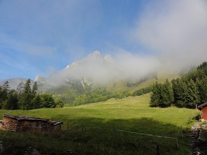
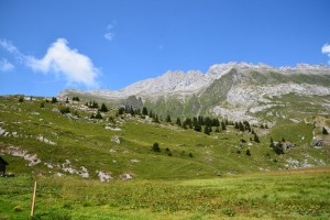
29/04/2017 - Tour del Moleson amb neu
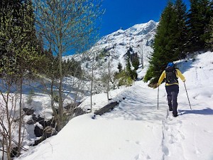 Pel pont del primer de Maig, en Jaume va venir a Suissa. La setmana havia sigut molt fred i plujosa. A finals del mes d'Abril i en vàrem trobar fins a 80cm de neu.
 La idea original era anar a fer la via ferrata que puja fins al cim del Moleson, però amb aquesta neu ens vàrem conformar a fer un bon passeig per la neu, estirar les cames i fer una raclette a Gruyere.
08/04/2017 - Kaaterskill Waterfall, New York
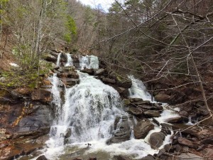 After an intense week with the Honeywell connected homes team, working on documenting architecture, I had an almost free Saturday, my plane was at 19:00, and I didn't want to spend my day at the Long Island beaches. At about 2h from New York city, there is the Catskill Mountains, it's a typical place for the newyorkers to go and breath some fresh air. A friend recomended to visit the Kaaterskill Waterfall and so I did. It's an easy walk, provably in 15 mins from where you park the car.
02/01/2016 - Puigllançada
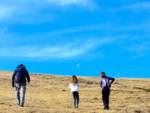 Aquest Nadal vàrem voler fer amb l'Angel, la Isa, en Jaume, la Neus i els cunyats de l'Angel. El temps no pintava massa bo, pero al final s'ens va obrir una clariana, el que va permetre a l'ultim moment organitzar una pujada al Puigllançada, al costat de la Molina. Després a dinar a Puigcerda amb la Montse i en Narcis.
30/10/2015 - Coll Formic - Matagalls - Sant Marçal - Sant Bernat
 L’excursió l’hem feta un dia clar d’octubre amb tots els colors de la tardor... Comencem amb una trobada Sant Bernat del Montseny, on deixarem un cotxe, ja que aquest serà el nostre punt d’arribada. Amb cotxe anirem a coll Formic. D’allà farem el cim del Matagalls, baixarem cap a Sant Marçal i tornarem cap a Sant Bernat.
 27/09/2015 - Le Grande Jumelle (2215m)
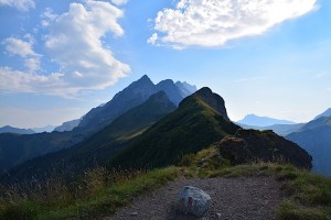
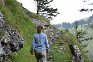
 Des de que vàrem fer l’excursió al llac de Tanay que teníem ganes de pujar a "Les Jumelles". Son unes muntanyes en forma d'enforcadura, recorden els encantats o el Pedraforca. Aquest cap de setmana ens hem decidit a fer-ho. La preparació va ser una mica mes difícil del previst, va costar força trobar la ruta. El camí no esta marcat, i els camins i rutes dels voltants expliquen com pujar al Gramont, però no a les Jumelles. Tot i això es fàcil de trobar "posts" que parlen de que l'han fet, però a cap d'ells hi ha el fitxer GPX o cap ressenya. Tots en parlem com si ja sabéssim per on anar-hi. Al final vàrem tenir un cop de sort i després de molt buscar, vàrem trobar un parell de fitxers GPX.
L'excursió es puja molt be al principi, la part final una mica vertical i acaba amb una grimpada molt senzilla.
El dia va ser esplèndid, una mica núvol per començar, el que ens va fer pujar frescor, sol al cim amb un mar de núvols impressionant al fons de la vall
I per acabar un rösti.
13/08/2015 - Les Chaux - Chau Ronde - Taveyanne
 At the highs of Gryon ski slopes, there is a small mountain village called Taveyanne. You can only get to Taveyanne by car in summer; in winter the road is fully covered by snow and you will have to access with snowshoes or skies. It’s a typical high altitude Swiss cluster of home in the pastures.
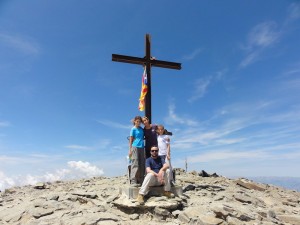
The hike starts at the “les Chaux” cable-car exit; first you walk the ski slope to get to the Chaux-Ronde summit. The summit is signaled with a huge wooden cross. From there a narrow trail traces the crest of the mountains, the trail will then go down trough the pastures, forest and finally to Taveyanne, where we will take the 4x4 track to get back to the cable car.
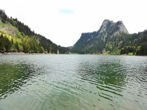
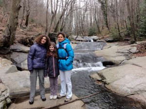
12/08/2015 - Creux de Champ,Diablerets
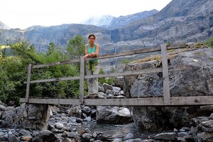 Creux de Champ has been a surprise. Our intial intention was to strech our legs, but the hike has surprised us with incredibles views and majesitc waterfalls with the source on the Glacier 3000 glacier.
11/08/2015 - Miroire d'Argentine tour
 Miroire d'Argentine is an impressive group of mountains located in Bex municipality, in Canton Vaud, Switzerland. The formation majestically rises above Solalex pastures.
 10/08/2015 - Roc du Châtelet desde Solalex
 Avui hem anat a fer el que tenia que ser una passejada, en realitat hem fet una excursió molt interessant. El cami comença a la cabana de Benjamine, que esta a un parell de curves d'arribar al parking de Solalex.
 Solalex és una esplanada o pastura increible que hi ha al final del cami del mateix nom que surt desde la plaça de la Barbaluouse a Gryon.
13/07/2015 - Puigmal desde Núria
 Aquest estiu hem fet una petita estada a la Vall de Núria, ens hem refrescat als rius, hem muntat a cavall, hem descansat, i també hem fet el cim del Puigmal (2.910m) des de el Santuari de Núria. Per començar vàrem fer una petita parada per dinar al costat del Freser, però no a ribes, sinó que a la part alta del riu, a Queralbs. Després de dinar, agafem el cremallera i cap a Núria. L'endemà ens llevem d'hora per sortir d'hora a fer el cim, no volem que el sol ens no ens deixi arribar... de baixada, una refrescada al riu, activitats, sopar, dormir i qui vulgui dormir en tenda, i l'endemà a fer una passejada en cavall, baixar amb el cremallera, i per acabar aquestes mini-vacances en refrescant se al salt del grill.
24/05/2015 - Llac Tanay - desde Miex - Flon
 You can get to the small village of Tanay by Taxi, or by a 4x4. Otherwise, you have to park your car at the car park in Flon, from which point on there is a path for you to hike to Tanay. Nevertheless, in entering the town of Flon, there was a person organising where we were meant to park our car who did not appear like he would let us go on even if our car fitted the requirements.
There is a path that is well signaled to the right of the trail, right after the car park. The path goes through an alpine forest which protects us from the sun, but that doesn't stop us from sweating, seeing as the slope is so steep. Throughout our excursion, we met with several people, the majority of which were mountaineers - but do not be surprised to meet someone wearing ballerina shoes, struggling to climb the steep slope, slipping on the moving rocks under their feet.
As we arrive to the col of Tanay where the taxi stop is, we can see the first few houses. As we descend to the lake we can see the mountain refuges and restaurants.
The village of Tanay or Taney is the perfect base for the ascencion to the Grammont or Les Jumelles, but it is not time today. I am looking forward to coming back when we have more time.
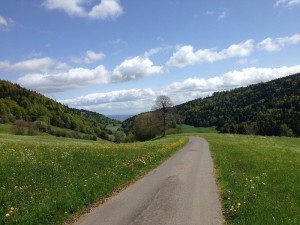
10/05/2015 - La Givrine - Haut Mont - Le Vermeilley
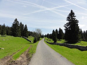 This weekend we went on a small excursion to the Col de la Givrine. The Col de la Givrine is situated above Saint-Cergue before arriving at the border between la Cure (Switzerland) and France. Surprisingly, the majority of the path is paved.. Next time we will take our bike instead.
The path is slightly uphill, and it is very well signaled, and is surrounded by many other paths which inspire us for future excursions.
Here, during the winter season, we can find people snowshoeing, or cross-country skiing, and even riding on dog sledges.
In the summer we find people riding their bicycles and most of all, a lot of people in the mountain restaurants to taste the typical swiss cuisine.
05/04/2015 - Panta de Santa fe del Montseny
 El Panta de Santa Fe del Montseny is one of the first natural parks I have ever visited. The walk was very calm - the greatest risk would involve getting angry at a tourist who thinks the mountain is an amusement park, or a space where everyone can have a barbecue without any sort of consideration or respect for the environment.
We arrived when there was still some space for us to park our car at the parking lot. It was a cloudy day and it was cold, which was why we decided to have a brief walk. We had work to do, and little interest in feeling cold.
The walk wasn't much more than an hour of stopping to take pictures at each flower sighted...
When we arrived at the parking lot, it was a total mess. Very chaotic, almost like the exit of a football stadium.
A recommended walk. If the weather happens to be nice, take advantage of it and make the excursion longer!
08/03/2015 - Bois de Chêne
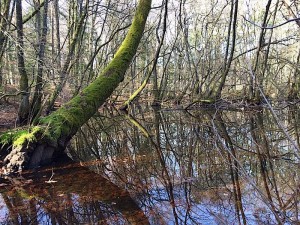 It appears that spring has started and with such sunshine, it is a delight, being able to stretch your legs in the forests around you. At the town of Begnins there is a forest of oak trees, which is a scientific reserve. Like everything around here, it is well maintained and signaled. It is a rather flat path - no inclination. In the middle of the forest we crossed a stream and small, clear lakes with an impressive mirror effect.
14/09/2014 - Rochers de Naye
 Above Montreux, there are the Rochers de Naye. The initial idea was to go from the col de Jaman to the summit, but in the end we decided to take a shortcut by taking the train that leaves from Montreaxu. The route taken by the train has some very impressive views. The excursion is rather vertical - it climbs about 500 metres in about two hours of walking. The most annoying part is that at the beginning, you constantly climb and descend, only to be at the same level. Once you arrive at the canal, the path climbs towards the col with impressive viewes of the Leman lake.
16/07/2014 - Núria, Finestrelles & Queralbs
On the weekend of the 12th of July, together with Jaume, Neus and Narcis, we wanted to hike from Núria to Carança but due to the bad weather, we decided to simply hike to the summit and return. The initial idea was to go up the Puigmal but as the excursion is long and a storm had been forcasted, we decided against it. Instead, we decided to hike up Finestrelles. When we arrived back at the Vall of Núria we realised we had lost the last the train, and as if we hadn't hiked enough, we were forced to walk all the way back to Queralbs, and ended up walking for 11 hours.
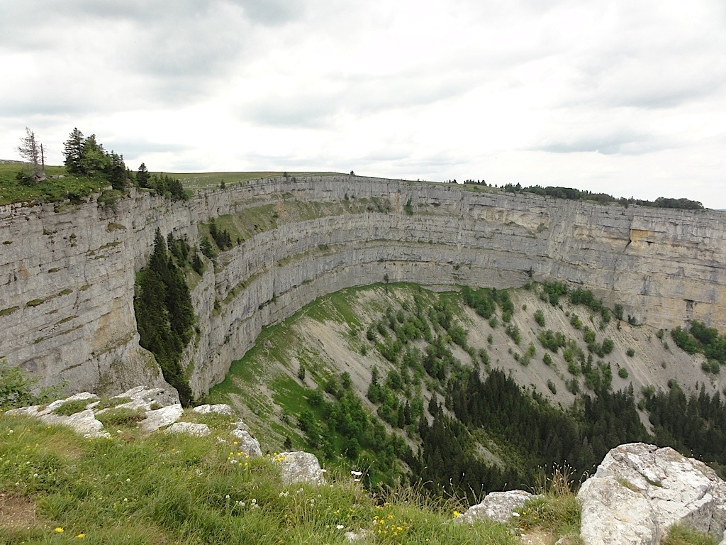
29/06/2014 - Creux de Van
 At the Vall de Travers, in the canton of Neuchâtel, we find a singular circ formation named the 'Creux de Van'. We were lucky enough to find a family of mountain goats - they were calmly grazing at our side as we were gaining altitude. The sights from the superior part of the circ are scary and it is rather annoying to see someone on a mountain bike or a stroller for children right next to you, right after your exhausing walk... but of course, they took the road to get here...
21/06/2014 - Le Grand Salève: Corraterie, la Grotte d'Orjobet i trou de la Tine
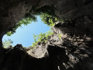 Just in front of Geneva, we have Le Grand Salève. The mountain is not very tall, but it does have a very vertical facade. In the superior part of this facade, there is an aerial passage that almost goes through the rock - it is the Corraterie. From the Corraterie we can see the Trou de la Tine, an impressive rocky formation, which seems, from far, an immensive cave, a hole in the wall but when you are inside you see there is no ceiling. Following the path a little more, we cross the Grotte d’Orjobet, a cave that is adapted with stairs that allow you to climb from 'Le Coin' until the Corraterie. The excursion is very aerial, with impressive views of the Montblanc, the region of Geneva and the Jura.
09/06/2014 - La Tine de Conflens
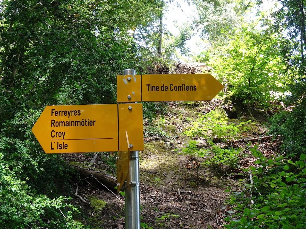 A simple 40 minute route from the train station of la Saraz. The climb is of about 100 metres. In 40 minutes you arrive at the dam. Its a magical place filled with energy from the forest fairies. There are two dams and a small beach. The water doesn't seem too clean, but its from the amount of organic matter there is in the forest.
18/05/2014 - Le Sentier - Vallorbe
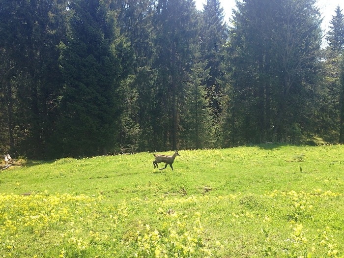 A simple route, strongly recommended, with very little uphill.
It starts very calmly near the 'Lac de Joux'. There are quite a few people, but these tend to be people that respect and love nature. At around the middle of the lake, you must climb a little to arrive to 'Le Lieux', where we continue touring the lake but this time at a higher altitude. In this route we have been fortunate enough to sight two deer or 'chamois' and they haven't shown themselves to be shy.
11/05/2014 - Vallorbe-Romainmotier
 We start at the camping place of Vallorbe, with a strong vertical slope untin we cross the col. From there, we descend through a minor road until Vailion. After crossing the village we enter once more at the forest, where we cross a defensive system (the toblerones) where we start once more to descend, following the river. In the last part, we walk next to the river and cross wooden bridges several times.
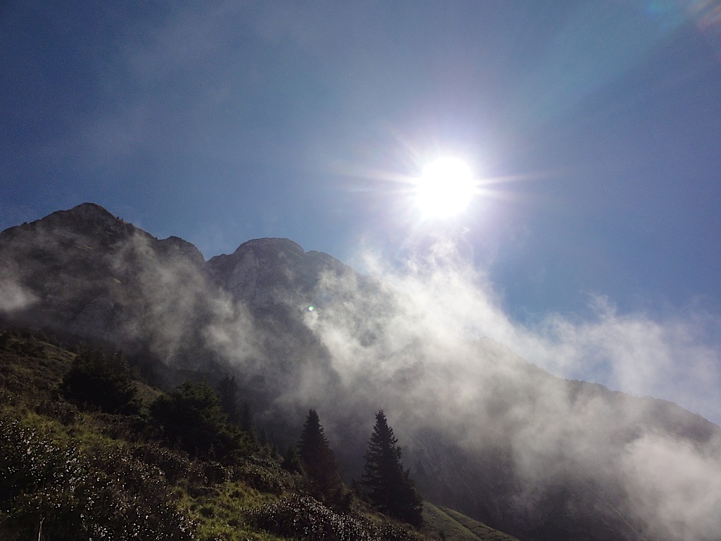
15/03/2014 - Shali Peak, Himachal Pradesh, India
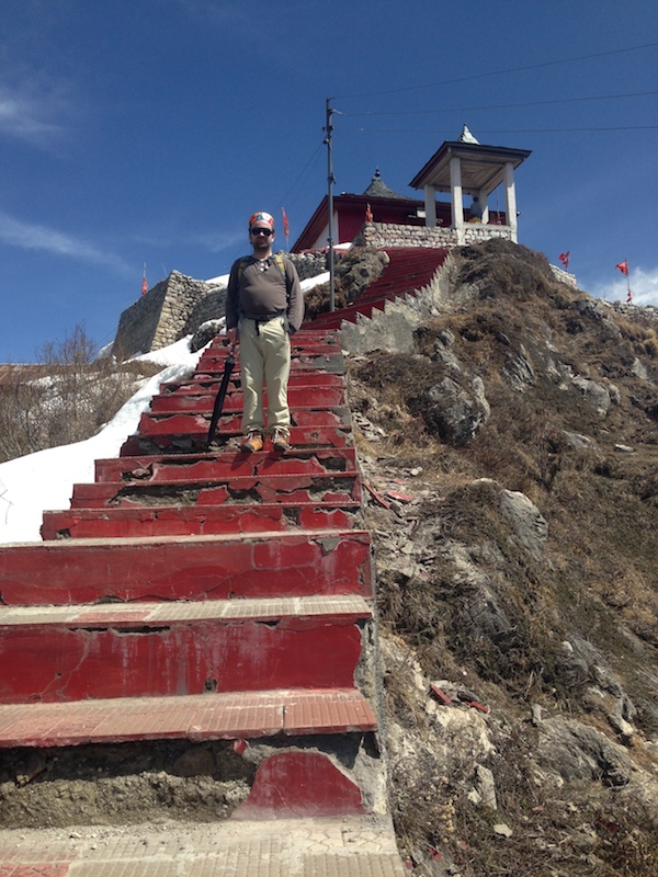 My work brings me to many places around the world. Lately, one of these frequent destinations is India. The city I visit is very close to New Delhi, and the large Himalayan mountains are not too far, only around 400 Km away. But in India, this means 10 hours of driving. Last time I went, I had a monday free, which gave me a three-day-long weekend and the perfect excursion for me to escape to the mountains.